
Trace a Kalamazoo Street by Address
For a Kalamazoo street search, begin with the address in the county parcel system or, for property inside the city, the city assessment database. Keep the parcel ID with the result. It is the steadier link when a road has a similar name, an address has changed, or several properties share an owner. The parcel card can identify a recorded owner and property facts, while the map helps place that parcel among nearby lots. Neither tool establishes every person who lives there.
- Search the address or street in the Kalamazoo County Parcel Search. A street name alone can return parcels along that road; record the parcel ID and municipality before treating a result as a City of Kalamazoo property.
- Open the parcel in the county or city map. Compare the parcel boundary, situs address, and surrounding lots instead of relying on a street label alone.
- Use the recorded owner and parcel ID in the Register of Deeds index. The purchase document and prior party names can supply dated links in a deed trail.
- If the goal is to check one person, use the Michigan voter service as an individual lookup. It is not a public street-wide roster, and protected fields stay protected.
- For an earlier household, consult the Kalamazoo Public Library street-order directories, plats, and maps. Preserve the volume year and printed address before connecting it to a modern parcel.
That sequence moves from a present address to records that can be dated and checked. It avoids treating one owner name, a map pin, or a single historic listing as a complete answer.
Kalamazoo Street Search Fields
The county’s parcel tool is built for owner, parcel ID, and street searching. A partial owner name can help when spelling is uncertain. Parcel IDs accept a whole number or its beginning portion, with hyphens, spaces, or no hyphens. Street searching is especially useful for a street directory task because a name by itself can return parcels along the road, while a street number can help when the road name is uncertain. Results still need a municipality and parcel check.
| Portal | Field or Control | Entry Type | Kalamazoo Search Note |
|---|---|---|---|
| County Parcel Search | Owner | Text | Any portion is accepted; the county uses surname and first-initial examples. |
| County Parcel Search | Parcel ID | Text | Use all or the beginning of the ID, with hyphens, spaces, or neither. |
| County Parcel Search | Street | Text | Use a number, a street name, or a street name alone to browse a road. |
| City BS&A | Address | Text | It defaults to address results; enter an address and use Enter or Search. |
| City BS&A | Record type/search by | Selector | The control adjusts the default all-records address search. |
| City GIS | Parcel click | Map control | A popup can link to the BS&A property record. |
County Equalization is also available for records that need staff help. The office is at 201 West Kalamazoo Avenue, Room 404, and asks visitors to make an appointment because staff availability is limited. Its published phone is 269-383-8960.
Kalamazoo Street Parcels on Maps
The City of Kalamazoo GIS maps provide parcel popups, layers, a legend, measure and print tools. A popup can lead back to BS&A, and the map layers include parcels, zoning, voting information, waste collection, natural features, and historic districts. Those layers are useful for understanding the location around an address, but the city describes its map as informational rather than a legal survey.
The City GIS map page shows the parcel-popup and layer tools used for Kalamazoo street directory research.
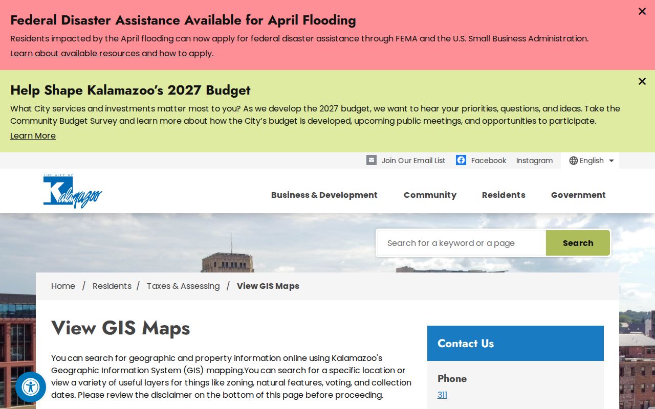
Use the popup to compare a parcel with its address record, then retain the parcel ID and source date in your notes. A measure tool shows map distance, not a boundary decision or a statement about occupancy.
- Parcel
- A numbered unit of land in the assessment and mapping systems. It helps connect an address, map location, and recorded documents.
- Situs address
- The physical property address. It differs from an owner mailing address, which only shows where tax correspondence may go.
- Plat
- A recorded map of lots, blocks, or a subdivision. It can bridge a street address to a legal description.
- Criss-cross directory
- A historic street-order directory that organizes entries by address rather than by surname.
Kalamazoo Street Names and Numbers
Street names and house numbers need their own check before an old result is matched to a modern address. Kalamazoo Public Library documents changes including Cork to St. James, Main east of the river to East Avenue, Michigan to Main, Oakland to Asylum, Riverview to Seminary, South east of the jog to Cherry, and Vine to Rice. Search both the historic and present street names, then cite the year of the map or directory used.
Kalamazoo also changed numbering citywide in 1925, and no city directory was issued for that year. The library recommends comparing the 1924 and 1926 volumes and using a 1932 Sanborn map to reconcile numbers. Pre-1883 directories use an older river and central-point system, so an early address is a historical locator until the street name, map, and directory evidence agree. Note: The 1925 gap makes a single unchanged-looking address an unreliable bridge between early and later records.
Kalamazoo Street Records at a Glance
Address-keyed sources overlap, but they do not mean the same thing. The assessment record is the best starting point for a parcel and recorded owner. GIS adds map context. The Register of Deeds supplies parties and documents. The city system can expose property, tax, sale, zoning, and permit material for city addresses. Historic directory and map sources help explain an earlier address. Joining them by parcel, date, document number, or legal description is safer than joining only by a name.
| Kalamazoo Address Source | Custodian | What It Can Show | Access Route |
|---|---|---|---|
| Parcel and assessment record | County Equalization or City Assessor | Parcel ID, owner, tax, sale, land, and building fields | County Parcel Search, city BS&A, office, or a specific request |
| GIS parcel map | County or city GIS | Parcel geometry, zoning, districts, and map layers | Online viewer, informational only |
| Recorded-document index | Kalamazoo County Register of Deeds | Grantor, grantee, type, date, document number, and parcel references | Free index, image or copy routes, and public workstation |
| Building permit history | City Building Department through BS&A | Issue and inspection dates with permit detail | City address search; a public code index was not identified |
| Street-order directories | Kalamazoo Public Library | Historic occupants, businesses, and address order | Edition-specific digital or library access |
| Plats and Sanborn maps | KPL, Register, and archives | Lots, blocks, structures, and historic street context | Catalog, library, archive, or recorded plat access |
Michigan Voter Information Center uses ZIP as a name-search narrowing field and accepts address information on its driver-license route. It does not create a public list of everyone on a street. A mailed or requested voter-file extract also has protected fields and use limits.
Kalamazoo Street Deed Trail
After the parcel search identifies a current recorded owner, move to the Kalamazoo County Document Searches page. The free index supports Name, Date Range, Liber/Page, Document Number, and Parcel Number modes. A deed trail normally starts by searching the current owner as grantee, recording the purchase document, then searching the seller as a prior grantee. Legal description, lot and block, and parcel number help avoid a same-name error.
The county document-search page displays the named, date, document-number, and parcel search routes used to extend an address record into recorded instruments.
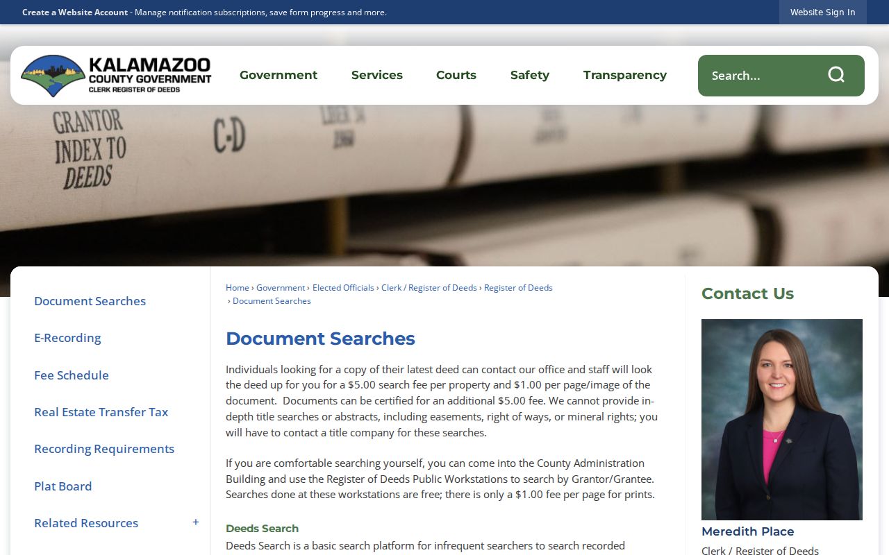
Keep the party role, recording date, document type, liber and page or document number, parcel reference, and whether an image or certified copy is needed. The county offers free index searching, one-time Tapestry EON searches at $8.75, images at $1 per page, a free public workstation with $1 printed pages, and a targeted latest-deed staff lookup for $5 per property plus page charges. Staff do not provide an in-depth title search or legal advice.
Kalamazoo Street Directories in History
Kalamazoo Public Library has city directories beginning in 1860 and street-order material beginning in 1897. A street-order section is the historical address-to-occupant layer, but its printed entry should be treated as evidence for that edition year, not a current-status claim. Transcribe the name, spouse notation when printed, occupation or firm, street number, street, and the volume, year, and page. Check the neighboring editions when a family or business appears to move.
The library’s historic-house research guide pairs the directory names section and street order with plats and Sanborn sheets. Its local material includes Sanborn years from 1887 through 1932, with a bound 1957 set noted by the library. For the wider directory collection and entry conventions, use the Kalamazoo City Directories route rather than treating a single street listing as the whole history.
Older work can continue at the KPL local-history room, the Archives of Michigan, or WMU collections. KPL lists microfilm prints at $0.20 per page. Each repository has its own access conditions, so confirm current copy and on-site rules before requesting material.
Kalamazoo Address Permits and Requests
For a City of Kalamazoo address, the BS&A property record documents a Building Department tab with permit history, issue and inspection dates, and details. Property Information, Tax Information, utility, invoice, sale-history, zoning, and building fields are separate tabs. A permit can date work at a property, but it is not a list of residents and should be read with the address and source date attached.
A public city code-enforcement index was not found in the reviewed official sources. For a missing, nonexempt government record, direct a narrow request to the responsible custodian with the address, date range, and record type. Kalamazoo County accepts requests through its FOIA page and Public Records Portal, as well as email, fax, mail, and in-person routes. Michigan’s usual response period is five business days, subject to the statutory extension process. Note: A specific request helps the office locate the intended record without turning a street search into a broad personal dossier.
Kalamazoo Street Ranges and ZIPs
The county Street Name Directory is a useful crosswalk before matching an address to a road segment. It records direction, street name and suffix, low and high address ranges, odd, even, or both-number parity, municipality code, ZIP, census tract, and location notes. One named road may cross municipal and ZIP contexts, so the segment matters.
For an address-level postal confirmation, use the USPS ZIP Code Lookup. USPS standardizes delivery information but does not confirm that a particular person is at the address. Postal city names are not municipal jurisdiction. Once the address is narrowed to a road segment, the Kalamazoo ZIP Directory explains the postal coverage cautions in more detail.
Kalamazoo Street Directory Limits
A parcel card, deed, GIS popup, voter result, or historic directory can identify a dated property or record connection. It cannot establish every household member, a non-owner occupant, a utility customer, or a current address from an old source. Michigan voter records withhold items such as driver or state ID numbers, full birth-date details, phone, email, and signatures. Driver and motor-vehicle personal information has separate federal restrictions.
Michigan’s Address Confidentiality Program gives qualifying people a designated address and mail-forwarding option. Its protection should not be defeated by combining map, parcel, voter, newspaper, or directory material. If an official result looks incomplete, that may reflect a lawful restriction or the limits of the source, not an invitation to search around it.
Lawful use. Kalamazoo address records are for personal, lawful research. Michigan anti-stalking and criminal-harassment laws prohibit using public information to track, threaten, intimidate, or harass another person.